 NERC Data Catalogue Service
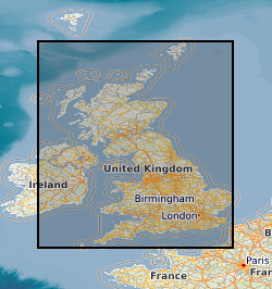
University of Aberdeen
Type of resources
Topics
Keywords
Contact for the resource
Provided by
Years
Formats
Representation types
Update frequencies
Resolution
-
Field photographs of rock formations or modern precipitates from the sedimentary environment. Samples were collected throughout the UK. This data was collected between February 2019 and November 2019. This data was collected to better understand the low temperature cycling of Telurium (Te) and Sellenium (Se) in the geological environment. For example, a range of ochre samples were included in this data. Ochres are a modern precipitate commonly found in rivers and streams which flow through geographical areas with a history of mining resources which are rich in sulphides. Iron from the sulphides are leached out and deposited downstream, coating river and stream beds, giving a red, yellow or orange colouration. Ochres can be a sink for trace metals such as Te and Se, therefore studying these environments could be informative from a resource perspective but also from an environmental hazard perspective. This data would be useful for researchers who require reference photographs for similar studies or as an aid for resampling.
-
Data comprise meteorological measurements (mean, minimum and maximum daily air temperature, minimum and maximum daily relative humidity, wind speed (kilometres per second at 10metres height), dew point temperature, estimated actual vapour pressure, precipitation, estimated surface resistance, estimated albedo and estimated Potential evapotranspiration (PET)) for the Siksik catchment, North West Territories, Canada for 2013 and 2014. The data were collected under Project HYDRA, a NERC funded UK research project linking Heriot Watt University, the Universities of Durham, Aberdeen and Stirling, and the Centre for Ecology & Hydrology (CEH), Edinburgh. Project HYDRA is part of the UK Arctic Research Programme. Project HYDRA studies sites in Arctic Canada to investigate the biological, chemical and physical controls on the release of greenhouse gases from permafrost into melt water and to the atmosphere and how these emissions will influence global warming. Full details about this dataset can be found at https://doi.org/10.5285/5bb560ee-15bf-4ab9-8c2e-3a76c688e69d
-
Summary output data (including soil organic carbon concentration, nitrogen, available water and carbon dioxide) from simulations of soil in a small agricultural catchment (Sunjia) in Southeast China (Jianxi province). The simulations were performed using the ECOSSE model; a pool-based carbon and nitrogen turnover model. The simulations were performed using soil and climate input data from the research farm. Input data for the simulations were provided by the soil science department of the Chinese Academy of Sciences. Simulations were conducted in 2017. Full details about this dataset can be found at https://doi.org/10.5285/2ce71612-df48-40f2-9402-03d93104c623
-
Data comprise sub-hourly discharge measurements including mean stream height, discharge and stream temperature collected at station S2 on the Siksik stream, North West Territories, Canada, between September 2009 and March 2010. Measurements were taken at a field site based at SikSik Creek a small sub-catchment of the Trail Valley Creek, approximately 60km north of Inuvik. The data were collected under Project HYDRA, a NERC funded UK research project linking Heriot Watt University, the Universities of Durham, Aberdeen and Stirling, and the Centre for Ecology & Hydrology (CEH), Edinburgh. Project HYDRA is part of the UK Arctic Research Programme. Project HYDRA studies sites in Arctic Canada to investigate the biological, chemical and physical controls on the release of greenhouse gases from permafrost into melt water and to the atmosphere and how these emissions will influence global warming. Full details about this dataset can be found at https://doi.org/10.5285/1ee887d3-aabd-4fb7-b48e-056229a15c6f
-
Data comprise pH and bulk density measurements (location (longitude, latitude), depth, bulk density) for multiple soil profiles in the SikSik catchment, North West Territories, Canada. Samples were collected along a transect in September 2014. Soil samples were taken near additional soil pits. Soil depth and sampling location (latitude and longitude) was recorded. Bulk density was determined according to Blake and Hartge (1986). pH was determined with the 1:5 soil:water suspension method (see supporting documentation). The data were collected under Project HYDRA, a NERC funded UK research project linking Heriot Watt University, the Universities of Durham, Aberdeen and Stirling, and the Centre for Ecology & Hydrology (CEH), Edinburgh. Project HYDRA is part of the UK Arctic Research Programme. Project HYDRA studies sites in Arctic Canada to investigate the biological, chemical and physical controls on the release of greenhouse gases from permafrost into melt water and to the atmosphere and how these emissions will influence global warming. Full details about this dataset can be found at https://doi.org/10.5285/a37e6aa4-b003-49bd-9a16-619a7d0dd714
-
Data comprise soil organic carbon content from a simulation using the ECOSSE model; a pool-based carbon and nitrogen turnover model. Simulations were performed using input data from the Sunjia research farm in southeast China (Jianxi province). Data here is from simulations using the global version of the ECOSSE model, a package which applies the regular model spatially. Input data for the simulations were provided by the soil science department of the Chinese Academy of Sciences. Simulations were conducted in 2018. Full details about this dataset can be found at https://doi.org/10.5285/876fa724-c3d3-4091-8de2-8140b7c973eb
-

Inductively Coupled Plasma Mass Spectrometry data, part of a suite of 51 elements using aqua regia ICP-MS techniques at ALS Minerals (Ireland).
-
There is a report highlighting the approach for model construction and recommendations for any future work. There is an excel file pf processed data including time, centrifuge speed, water pressure, and temperature data. There is a zip folder containing photographs of the models, the instrumentaiton and granular ice used for model construction There is a zip folder containing the raw data.
-
The data report plant growth parameters measured on six week old rice plants grown under two contrasting nitrogen treatments. The purpose is to conduct genome wide association mapping of nitrogen response and uses 229 cultivars of the Bengal and Assam Aus Panel. Traits are plant height, shoot dry weight, tiller number and two measures from a Dualex hand-held meter, the nitrogen balance index and the chlorophyl index. Full details about this nonGeographicDataset can be found at https://doi.org/10.5285/7ac2ba22-6915-43ca-93cc-d75b9c458b51
-
The dataset contains fruit counts (and counts of seeds within fruits), size measurements, and habitat characteristics for Pyracantha angustifolia, in Tafi Del Valle (Northwest Argentina). Data were obtained from field-based measurements of shrub characteristics in May 2019, when Pyracantha is fruiting. Also included are growth ring counts for shrubs of different sized used to predict the age of shrubs within the dataset. Full details about this dataset can be found at https://doi.org/10.5285/806eea81-1071-45af-a51e-d78f2a5fcd09